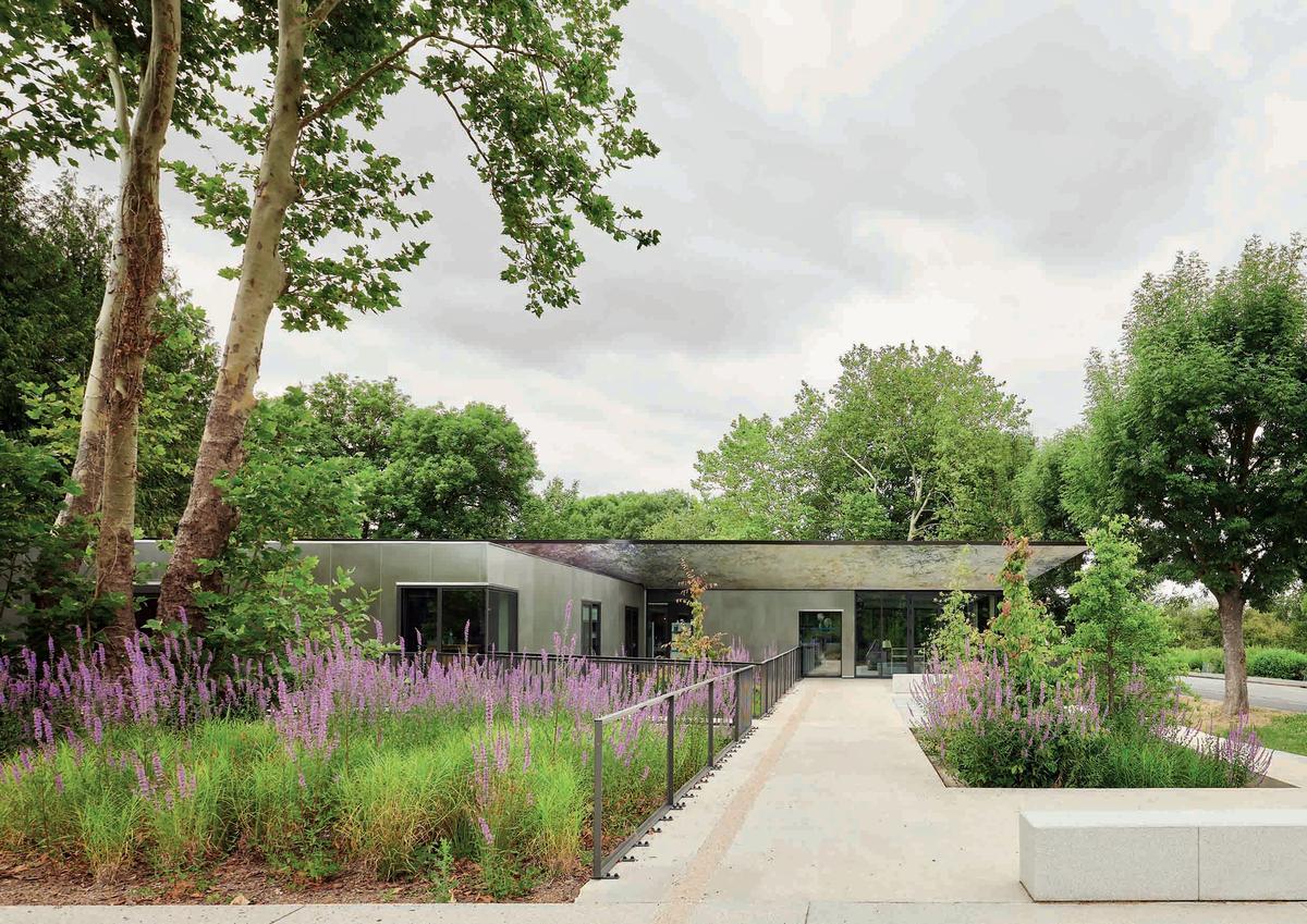
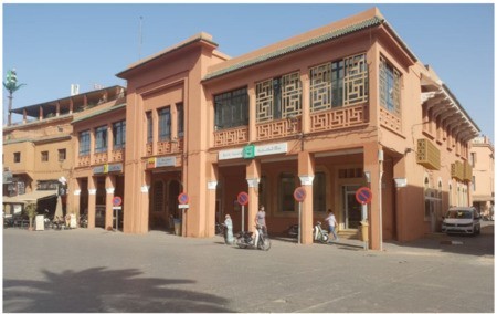
Smart Addressing - Eco-district Cœur de Grippon
Last modified by the author on 19/06/2019 - 16:52


- Year of commitment : 2015
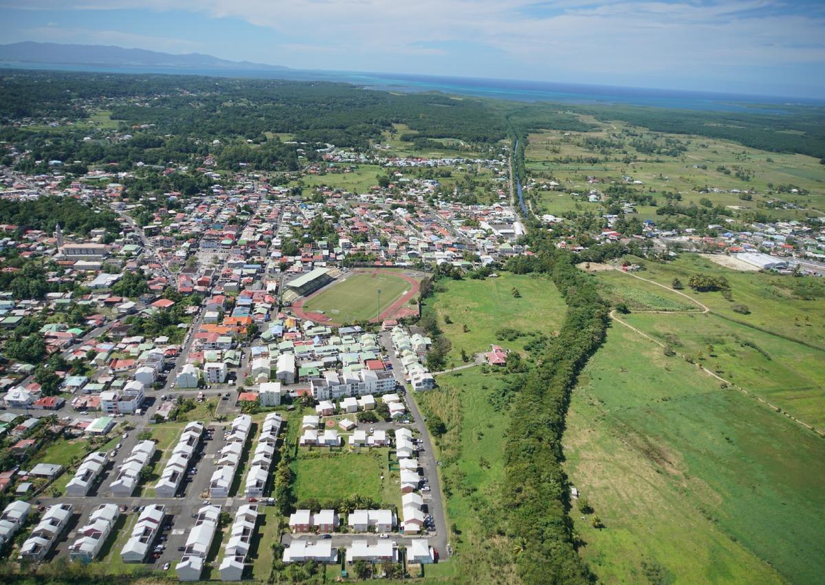
- Address 1 - street : HôTEL DE VILLE - PLACE GERTY ARCHIMèDE - 97111 MORNE-à-L'EAU, France
- Digital services : Applicative, Mobility, Water, Waste, Health, Comfort, Resilience, Safety
- Sustainable mobility : Accessibility
- Water cycle : Prevention, Protection
- Circular economy and waste management : Other
- Biodiversity & Ecosystems : / Urban ecosystem, Eco-tourism /
-
325 000 €
- Builder
CEC INFOG for the implementation of addressing - XERIA for the installation of addressing plates - South West Signage for the supply of plates - GFI for GIS - DFA Interactive for the development of the website of the city - Manager / Dealer
City of Morne-à-L'Eau
- To help users to easily appropriate the codes of this new eco-neighbourhood (sustainable energy management, mobility, responsible purchasing, tourism, waste, etc.)
- To make the user an actor by bringing people closer together and facilitating exchanges with local merchants and craftsmen and the services of the municipality
- Inform users about the life of their neighbourhood, important events or even natural risks
- To contribute to participatory tourism, to visiting the highlights of the eco-neighbourhood, to the city's eco-tourist spots, etc.
Progress Status
In progress
Data Reliability
Self-declared
Funding Type
Public
Website Enterprise / Infrastructure
https://www.ville-mornealeau.com/developpement-economique/adressageSustainable Development
- Working meetings were organized with the network managers to take into account their problems and to share the data
- The public service was also consulted via the SNA, the IGN, the cadastre and the DRFIP
- The municipality of Morne à l'Eau has become closer to the services of the Post Office. They were associated with the various work meetings and helped to draw up an exhaustive report of the buildings on the territory of the eco-district.
- Historians have intervened to help define the names of streets (people from the neighborhood or having lived in the neighborhood)
- The population has been associated in 3 public meetings dedicated specifically to addressing and is generally associated in the framework of the consultation related to the eco-district project (Awareness meeting, workshop, etc.)
|
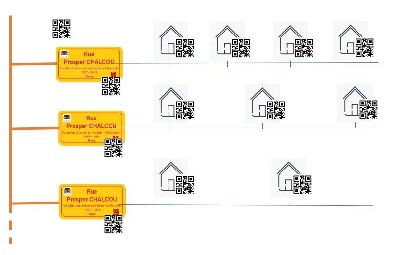
| The identification of the building achieved through the addressing system has significantly improved the knowledge and accessibility of the eco-district. This better visibility of the territory makes it easier to manage the interventions of the services to the population and the citizens as well as the management of the networks. The quality of services is thus significantly improved. All these aspects contribute to an improvement of the general quality of life in the eco-district. The system is also a tool for promoting tourism, art and heritage. Indeed, users, thanks to the QR Code, have the opportunity to learn about the history of a frame or the biography of the person corresponding to the name of the track. They can also better identify themselves on the territory. |
The addressing system makes the tax aspect more reliable, thus contributing to the improvement of tax fairness. Indeed, it is now possible to attach a building to a cadastre and a fiscal invariant.
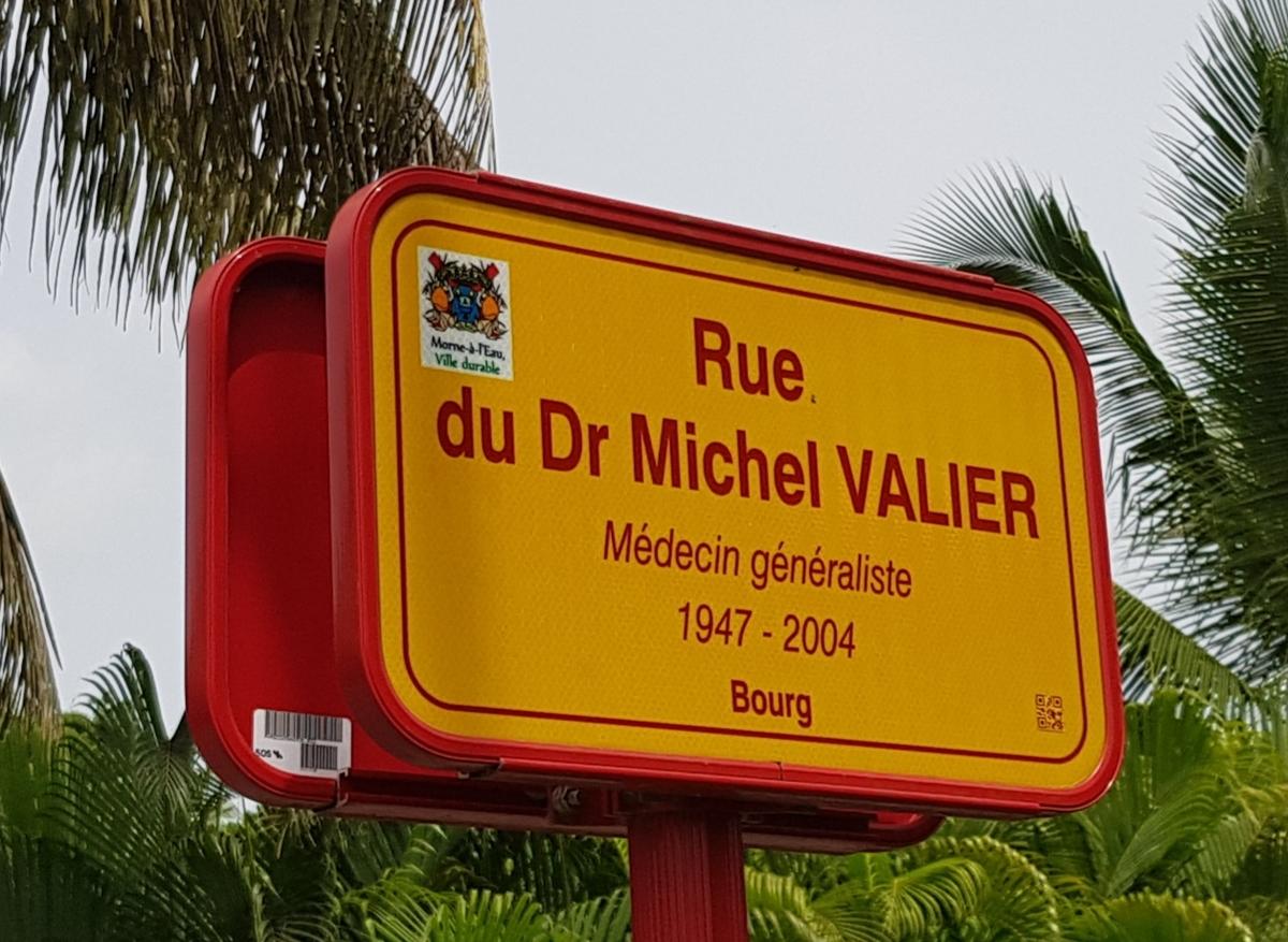
Street signs also generate social links. They thus highlight residents or residents of the eco-district. For example, the cyclist Camille DARIDAN recognized champion in Guadeloupe, Julien LAMEGO masseur of the football club of the city, or Eddy GUSTAVE musician saxophonist.
The project participated in the creation of a social and solidarity economy since the company in charge of laying street signs and houses favored the insertion for the works.
The smartphone application allows for the putting in contact of the inhabitants of the district for exchanges of services, for the organization of events.
| The addressing system allows the technical services of the city a better control of their territory. This very fine knowledge of the eco-district makes it possible to facilitate the maintenance and maintenance of the spaces thus preserving the environment. In addition, this system allows citizens to correctly explain their place of residence thanks to the accuracy of the address where it is located. This contributes to the reduction of motorized trips. In the case of emergency intervention even in areas of spontaneous housing the location is effective. |
Natural risks are very present on the territory of Guadeloupe. The best control of the territory allows the town of Morne-à-L'Eau to improve its organization in the face of these risks. Communication in times of risk will be facilitated.
The project has contributed to local economic development since the town of Morne-à-L'Eau has called on a local company based in Guadeloupe for the design and development of the system.
Testimony / Feedback
Press articles:
- Article France Antilles of 11/03/2017: "Geolocated addresses for all"
- Article France Antilles from 05/03/2017: "The streets are named and houses numbered"
- Advertorial: Interview of citizens on the subject of addressing
Governance
- Inhabitants
- Associations and companies
- Dealers: EDF, Régie des Eaux, SYMEG etc.
- The Regional Directorate of Public Finances
- The State
- The post office
- AMO: CEC INFOG
- by the DETR (Equipment allocation of the Rural Territories) paid by the Prefecture of Guadeloupe
- the FAC (Municipal Assistance Fund) of the County Council of Guadeloupe
- the CANGT (Greater North Agglomeration Community)
- the Town of Morne-à-l'Eau (CDC BANQUE DES TERRITOIRES Loan)
- TEPCV (Ministry of Ecological Transition)
City of Morne-à-l'Eau
Local Authority
CEC INFOG for the implementation of addressing - XERIA for the installation of addressing plates - South West Signage for the supply of plates - GFI for GIS - DFA Interactive for the development of the website of the city
City of Morne-à-L'Eau
Public
For the addressing system, the project was conducted in consultation with a set of partners:
The addressing project is funded by:
For the application:
Sustainable Solutions
- To help users to easily appropriate eco-citizen reflexes (sustainable energy management, mobility, purchasing, tourism, waste, etc.)
- To strengthen the Cœur de Grippon eco-citizen community by providing a space where eco-citizens can exchange best practices...
- Facilitate exchanges with local merchants and community services
- Inform users about the life of their neighbourhood, important events or even natural risks, etc.
- To communicate with services and between neighbours, to ask questions, etc.
- To participate in surveys
- To report a problem or malfunction
- To join the social networks of the municipality.
- Quality of life :
- Mobility :
- Smart city :
- Urban project governance
- Promotion of cultural/ historical identity
- Security
- Digital services
- Water management
- Waste management
- Management of natural areas
Phase 1 - Addressing System
Following the implementation of the intelligent addressing system, the city of Morne à l'Eau wishes to develop an innovative tool to communicate with the population and users of Morne à l'eau. This tool is based on the database developed in the "smart addressing" phase, which will thus form the basis of the mobile application. Indeed, the organization of precise data building by building and street by street will allow great flexibility for the city and users to communicate in a targeted manner. The purpose of this application is in particular:
The platform allows, unlike the website, to target information as closely as possible and to organize it, not at the scale of the city, but at the scale of the eco-neighbourhood and each dwelling. Two versions will be available: one very detailed for the inhabitants and the other dedicated to visitors to Cœur de Grippon.
News :
The city communicates with its users and keeps them informed of the latest news. These may concern the whole district or a street, etc. They appear on the smartphone in instant notification.
Current events: The shared garden organizes a guided tour. Large sale on rue Achille René René Boisneuf on January 12 from 8am. The street will be pedestrianized for the occasion.
Local shops:
The user has access to information relating to local shops: location of shops, opening hours, events organised...
My house:
An identity card is created for each dwelling, linked to a QR code. This sheet identifies the following minimum data: area, year of construction, environmental label, etc. For heritage buildings, the identity form will be completed with an information form that will relate the historical and architectural information of the house (included in the culture tab).
Waste :
The user has access to information related to waste: the nearest waste facility, opening hours of the resource centre, frequency of waste collection, waste fate, tutorials to properly fill bins and reduce waste, contacts for the removal of WEEE, urban composting point, etc.
Interactive map :
An interactive map showing the neighbourhood's places of interest, public transport stops, local shops and services, ecotourism, positioning of public car parks, charging stations for electric cars, neighbourhood services (restaurants, shops, etc.), etc.Mobility :
A tab will present the different ways of moving around the neighbourhood and a focus will specify the details specific to each way: Public transport: schedules, frequency, etc. - (Ultimately in real time) Electric cars: electric charging stations on the scale of the Vélo district: presentation of cycle paths, parking points, electric charging points Morne à l'eau Cyclopousse: online order of a cyclopousse, pedestrian availability: pedestrian paths, theme pedestrian paths.
Natural hazards :
Natural risks are an important issue in Guadeloupe. In order to be part of a climate change adaptation process, the district will integrate the most accurate information on risks. This tab will allow you to: To make users aware of natural risks: awareness films, etc. To present the strategy at the neighbourhood level to make users safe (shelter areas, paths to be taken, etc.) For each dwelling to specify, with regard to the studies carried out, the vulnerability (risks concerned, etc.) To communicate in times of risk: natural risk alert, procedure to be followed, etc.
Biodiversity :
The eco-neighbourhood is characterized by natural areas of great richness. This tab will present information related to the different biodiversity areas: details on species, routes on biodiversity...
Energy :
Energy is an important theme in the eco-neighbourhood. This tab could be widely developed and contain in particular: Information related to the overall energy consumption of the eco-neighbourhood (with a history in order to identify variations - these variations will be analysed and recommendations will then be proposed) Information related to the renewable energy production of the district Information related to the energy renovation of the building (associated subsidies...). Energy competitions may also be proposed (the most economical inhabitant, actions to reduce consumption, etc.). ) as well as elements aimed at raising users' awareness of eco-actions.
Grippon Heart Community:
In order to promote the circular economy and short circuits, the platform will offer a forum dedicated to bringing residents together so that they can exchange services or objects (sale, loan, etc.), organize events in the neighbourhood, promote an association, etc. A special page will be dedicated to building materials throughout the construction site so that residents can exchange building materials (as part of major renovations).
Works :
The eco-neighbourhood project will generate major works that may cause nuisances for users. Also, a specific tab will allow the city to discuss the planned work and inform the population (at the neighbourhood level or street by street) of the work and the consequences to come. Pedagogical information may also be provided: details of the work, description of the project, total duration, planning of noisy phases, what are the repercussions of the work in progress for the inhabitants, etc
Tourism, art and heritage: As the platform is organised thanks to the QR Code, residents and users will be able to scan "buildings", "streets" or "squares" and learn about their history and specificities. Thematic tours may be proposed (on history, biodiversity, etc.).
Finally, an exchange space will allow users to exchange information:
- Quality of life :
- Mobility :
- Economic development :
- Smart city :
- Resources :
- Biodiversity :
- Energy/climate :
- Citizen participation
- Promotion of cultural/ historical identity
- Proximity services
- Security
- Air quality
- Circular economy
- Soft transportation
- Electric vehicles
- Parking management
- Infrastructure
- Digital services
- Water management
- Soil management
- Management of natural areas
- Climate adaptation
Phase 2 - Application smartphone
Reasons for participating in the competition(s)
The city of Morne à l'eau has developed an intelligent addressing system that represents a major innovation in terms of controlling its territory. Each address and street name is associated with a QR code linked to a database. This system has made it possible to make the existing built and road data more reliable, to establish a reference in terms of development, and to offer users better safety and greater efficiency thanks to better control of the territory.Building candidate in the category

Grand Prix Infrastructure Durable
Other case studies
Contest