Parc Marianne ecodistrict, Montpellier
Last modified by the author on 14/06/2016 - 11:53
- Address 1 - street : 34960 ETOILE RICHTER, 45 PLACE ERNEST GRANIER, 34960 MONTPELLIER, France
- Gross density : 50 logt/ha
- Starting year of the project : 2010
- Delivery year of the project : 2018
Proposed by :
-
40 ha
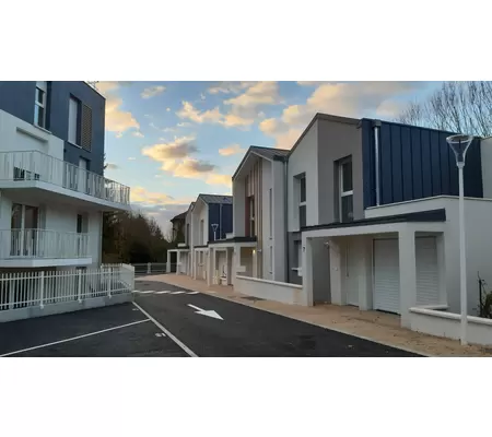
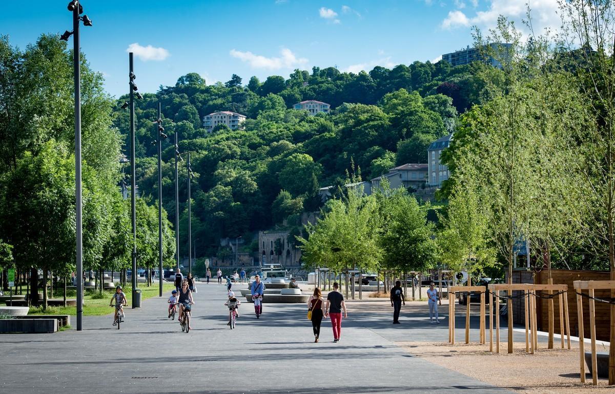
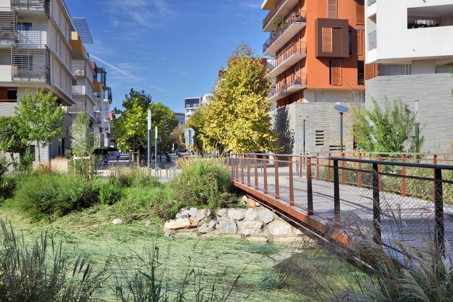
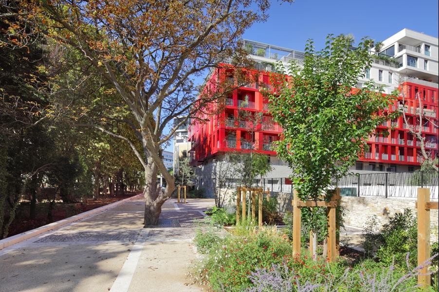
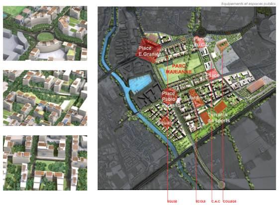
Enjoying a strategic location in the east of the Montpellier, Parc Marianne eco-district primarily efforts on the quality of life of its inhabitants. It opens to the Mediterranean by the Dugrand Raymond Avenue, rambla configured to accommodate a new tram line.
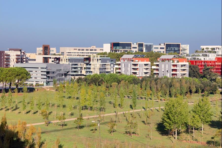
Parc Marianne is a mixed neighborhood, combining shops, offices, public facilities, cultural and housing. Along the avenue buildings form a dense facade, pulsating shopping and park side, they stepped to homes and offer views on the vast green lung Georges Charpak park.
In order to reconcile the scale of the city across the pedestrian, the geometry of the frame and the molding of Parc Marianne buildings will meet and interact with the park and green spaces. They create a real piece of the city where quality of life is synonymous with environmental quality. Built heritage become quality public spaces, geometry of the landscape and the ripple of the river are the two movements that have served as guides to the urban composition. Parc Marianne neighborhood surprises with its ability to combine city and nature, quality of life and centrality. This specificity is organized around two main points: environmental quality and a strategic location. Looking ahead, the project has also been awarded with the prize EcoQuartier2011 in "global ecological approach" category.
Programme
- Housing
- Offices
- Businesses and services
- Public facilities and infrastructure
- Public spaces
- Green spaces
Project progress
- Delivery phase
- Operational phase
Procedure type
- Urban développement permit
Key points
- Quality of life
- Economic development
- Mobility
- Biodiversity
Approaches used
- Ecodistrict national label
More info
http://www.montpellier.fr/3345-les-zac-de-montpellier.htmData reliability
3rd part certified
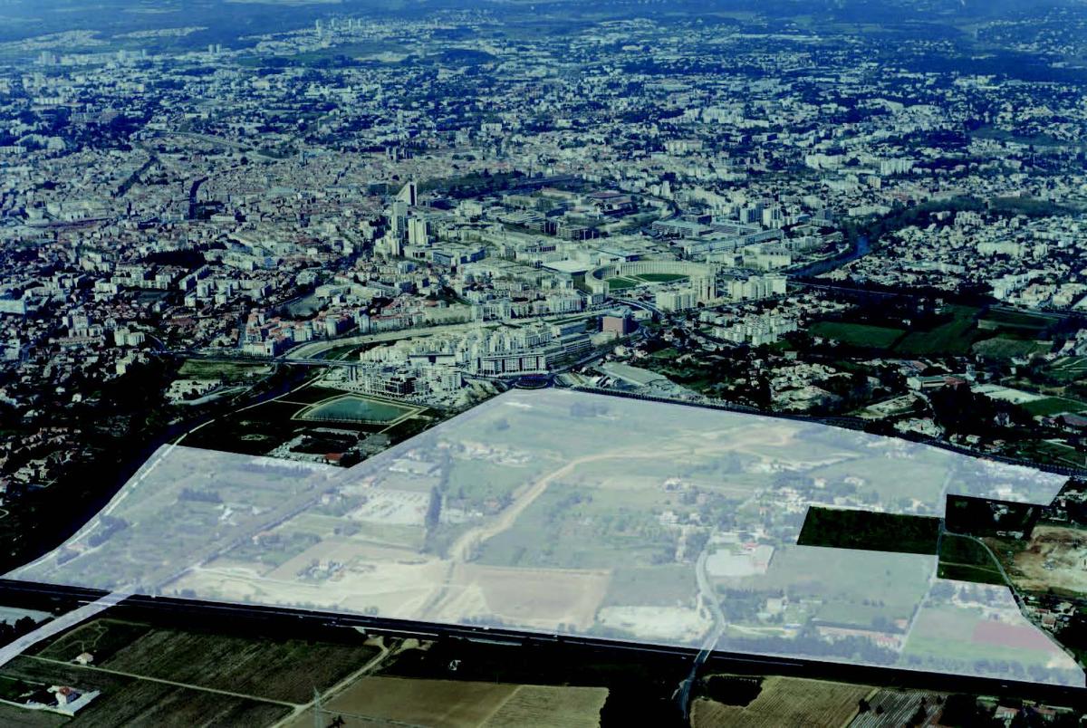
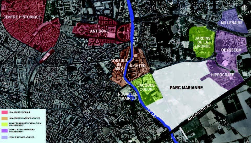
Type of territory
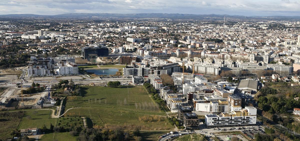
Parc Marianne is one of the central districts of Port Marianne, with Richter at Northwestern and Jacques Coeur in the West. It aims to be a mixed neighborhood where habitat predominates on businesses and activities.
Climate zone
[Cfc] Marine Cool Winter & summer- Mild with no dry season.
More info
http://www.montpellier.fr/3345-les-zac-de-montpellier.htmGreen areas, roofs included
80 000 m²
Public spaces area
14 000 m²
Office floor area
20 000 m²
Commercial floor area
6 000 m²
Housing floor area
2 000 m²
Number of residential units
2 000
Number of social housing units
600
Detail of subsidies
The balance sheet is even. It amounts to € 110 millions HT, funded by land sales charges and community participation in public facilities of primary infrastructure.
Project holder
Project management
Project stakeholders
SERM
Developer
Alongside the community since 1961, SERM, equipment Société Region Montpelliéraine, implements and supports the implementation of urban projects. In a few decades it gave substance to the development of the city of Montpellier and its agglomeration, experiencing one of the highest population growth in France. For years, the SERM has linked its name to the key achievements that have allowed the City to welcome new residents. This ability to support their growth while respecting the requirements of an urban quality policy, is expressed today through the construction of new neighborhoods such as Port Marianne.
Etoile Richter 45 Place Ernest Granier CS 29502 34960 - MONTPELLIER Cedex 2 [email protected]
http://www.serm-montpellier.fr/
AS ARCHITECTURE STUDIO
Construction manager
Following the public call for competition, the Architecture Studio group, Square Green and Imagine was chosen to achieve the definition of urban studies and to execute the mission planner-coordinator Marianne future district park (MNT4).
10 rue Lacuée 75012 Paris - [email protected]

Quality of life / density
Net density
Social diversity
Social inclusion and safety
Local development
A major area of circulation
- Direct link between the coast and the center of Montpellier
- Near the highway to the international airport, the TGV station and the sea
Services and activities
- Business center
- Shops, pubs and taverns
Functional diversity
The BIA is composed of an overall floor area of 100,000 m², of which 80-90% of multiple housing ranging from 6 storeys to 9 storeys high. The program also addresses the social diversity of requirements and functional diversity by offering different types of accommodation (home ownership, and 20-30% of assisted and social housing) and 10-20% of offices, shops, local services and activities.
% of public spaces
% of office area
% of commercial area
Mobility strategy
Marianne Parc benefits from a strategic situation. The area offers the comfort of a particularly efficient traffic network with:
- Major roads served by the landscaped avenue Pierre Mendes France: highway, airport ...
- The tram line 1 of the World Avenue 98 (stops: Port Marianne and Millennium)
- The Line 3 project on the Avenue de la Mer
- The creation of a new south urban boulevard and the transformation of the Avenue of the Sea in a major axis
- A cycling network secure, wide sidewalks and walkways
- 1 and 3 tram lines, with a tram station (T1) World 98 directly serving the neighborhood north side, and the station "Pablo Picasso" T3 serving the south.
Biodiversity and natural areas
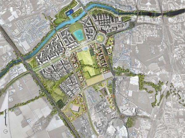
The habitat is designed around a large wooded park of about eight hectares, crossed from end to end by the river Lironde. Wide aisles facing south will add to the coolness of the water, natural ventilation and southern brightness. And the presence of pergolas optimize the interaction between an inner snug organized by each, and exceptional environment to enjoy the privileged climate. To the west, the basin Jacques Heart (future marina) and the Lez reinforce the attractiveness and originality of this urban area, carried around a farm originally natural heritage.
The vast park landscaped by the City is the lung area. Extending the basin Jacques Heart, it creates an axis of transparency between the projects of the City Hall and the Contemporary Art Centre. The urbanization of the area is organized around this axis ...
"Some agricultural plots will be organized around a large meadow and each plot will be abundantly planted with trees. Green and white oaks, almond trees and ornamental fruit trees will be planted on dry land under a strict alignment, however, disturbed by groves of pines. "Michel Desvigne.
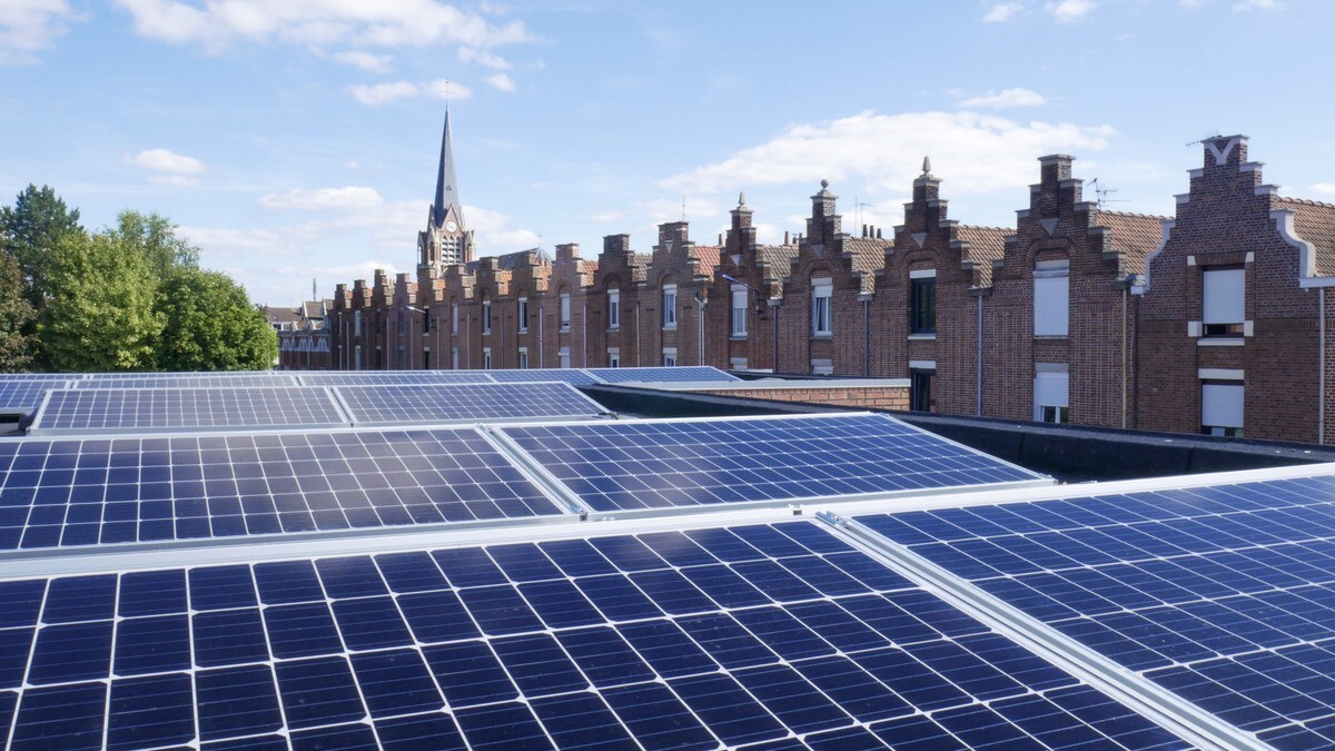
Energy sobriety
Energy management is a strong point of the neighborhood. The accommodations are designed with an objective of low energy consumption. They are equipped with solar panels to produce hot water, photovoltaic panels for electricity supply and for some, external insulation. In addition to these facilities, the area will be served by a district heating network supplied based renewable energy: wood.
Energy mix
- Collective district heating plant with a wooden
- Solar panels for hot water production
- Photovoltaic panels
Link to Buildings of the area in Construction21 database
)
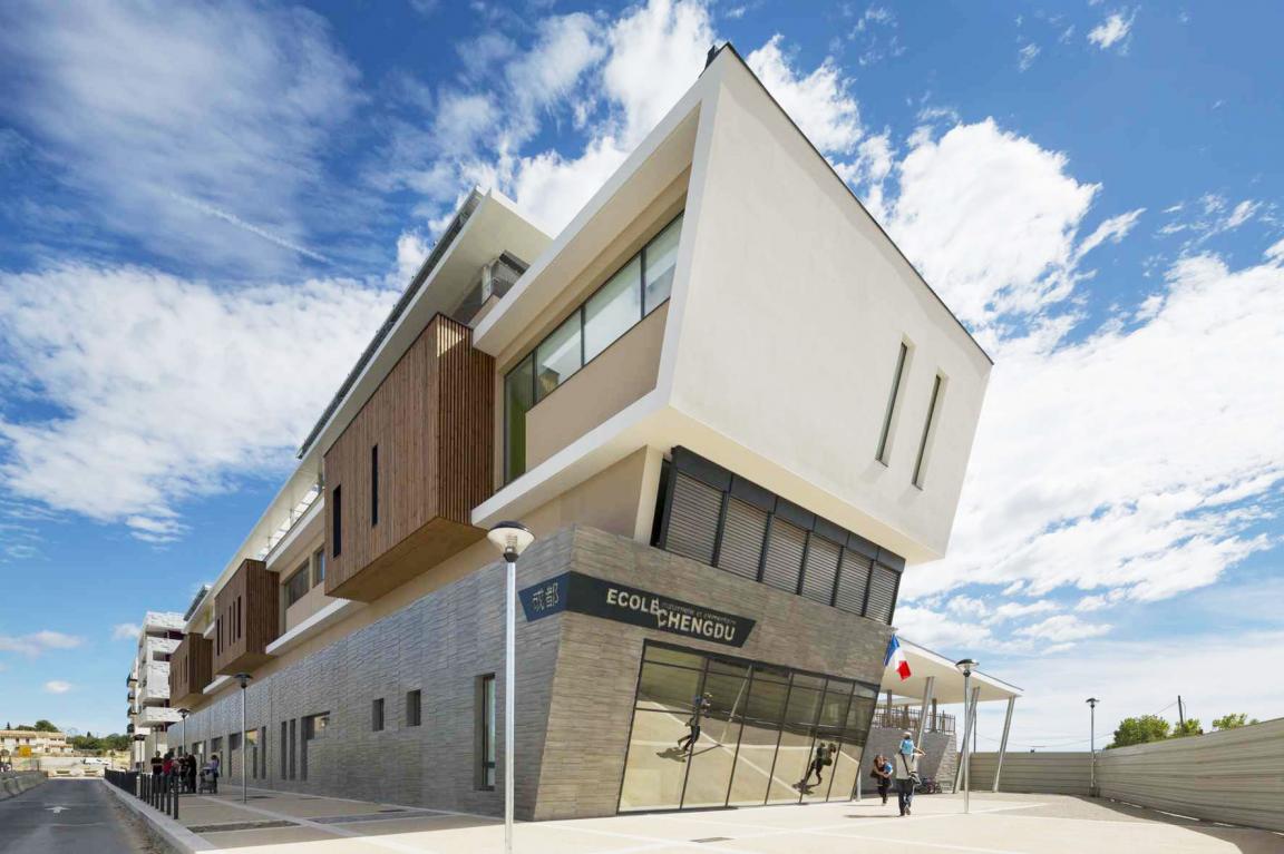
Groupe Scolaire Chengdu
Construction NeuveEcole, collège, lycée ou université